2011年8月28日日曜日

世界遺産の石見銀山


大久保間歩野中から入り口を見ています。
きれいな景色が好きですか?でも京都の混んでいるお寺はあなたの観光経験を悪化してしいませんか?あなた向けの観光所を紹介します。島根県の大田市の石見銀山(いわみぎんざん)は1520年代から1900年代の始めにかけて連続的に掘られました。1600年代間石見銀山の銀堀業により日本は世界で三番目に大きい銀を作っている国でした。1800年代が終わって1900年代が始また時石見銀山は海外の銀堀業と競争出来なくなりました。その結果石見銀山が閉めれました。堀業の科学者によると残っている銀量は50億円ぐらいです!でも1950年代に文部省は石見銀山を国指定史跡に登録しました。2007年に石見銀山は世界遺産に登録されました。世界遺産に登録されても、石見銀山は遠く離れて居る所だし、認知も少ないから訪れる人の数は少ないです。
龍源寺間歩の入り口。
龍源寺間歩の中。
 石見銀山は松江に宿泊している人にとって良い日帰り旅です。朝電車で大田市まで乗って行って下さい、午前7時18分に普通列車(¥1110片道)か8時36分の特急まつかぜ(¥2260片道)がおすすめです。午前10時の間石見銀山へ行くバスがないですから午前10時前か午前11時以後に到着したら良いです。石見銀山の最も面白い場所は銀を掘っていた所です。“間歩”と言われています。2つの間歩に入る事が出来ます。一番広告している間歩は“龍源寺間歩”と言います。龍源寺間歩は大森バス亭から2.3キロ、大森村の本道の坂の一番上に有ります。大森バス亭で貸し出し自転車が有ります。普通の自転車の3時間レンタル代金は¥500です。電気自転車の3時間代金は¥700です。龍源寺間歩の入場料は¥400です。外国人は最も幸運です。パスポートまたは登録証明書を見せたら50%引きがもらえます!江戸時代の前に、ダイナマイトが発明された前に、日本に輸入された前に掘られていた龍源寺間歩は手道具で掘られました。その結果、間歩の壁の手触りは滑らかです。間歩のあっちこっちに他の銀鉱石が掘って残った穴が有ります。いくつかの穴に入る事が出来ます。本当に面白いです。間歩の中の気温は18度ですから龍源寺間歩訪ねは素敵な冷える方法です。龍源寺間歩の深さは158メートルです。その後間歩が90メートル続けるけどトンネルが狭く成るし岩の状態は不安定ですから158メートルの所から1900年代に掘られた観光的なトンネルで龍源寺間歩から出られます。2番目の入れる間歩は“大久保間歩”と言います。ツアーは石見銀山世界遺産センターで案内されています。大久保間歩ツアーは 金、土、日、国民の休日に、一日に4回(午前9:30、10:30、午後12:15、1:15)しか行われていません。計画を注意して立ってて下さい。参加料金は¥3800です。大久保間歩は1550年代から1800時代にかけて、手道具でもダイナマイトでも連続的に掘られました。龍源寺間歩に比べて大久保間歩は最も大きい(トンネルの中の一つの所の高さは10メートルぐらい)でも造成はあまり有りません。大久保間歩に入ると長靴をはかなくちゃいけないし、ヘルメットもかぶらなくちゃいけないし、懐中電灯も持たなくてはいけません。間歩の中の気温は13~14
大久保間歩の入り口。
度ですから温かい服も着なければなりません。長靴とヘルメットと暗い状態で昔の銀鉱労働者の実感が出来ます。間歩の中で下まで見えない深い掘って残った穴と何百年前に作られた木橋と鉱石カート木鉄道遺跡を見る事が出来ます。大久保間歩の堀歴史も見えます。江戸時代の前の手道具で掘った壁は小さくて(高さ1メトル以下)滑らかな4角の形です。江戸/明治時代、ダイナマイトで掘られた壁は大きいと荒いです。ダイナマイトのためのドリルで開けた穴も見えます。大久保間歩の回りはきれいな山林ですから大久保間歩までのハイキングもきれいです。楽しんで下さい。
山吹城跡からの三瓶山。
大森の本道。
 間歩を訪ねた後江戸時代的な大森村で歩いたら良いです。アスファルト道と建物で付けたエアコン機以外昔の日本の経験が出来ます。大森村でたくさん歴史的なの旅館と店と自宅が。入場料がかかる所とかからない所も有ります。清水寺から龍源寺間歩の山吹城跡経由ループハイキングコースも有ります。でも山の頂上に何も有りません。土台石見たい人にとって残念です。でも頂上から島根県の最大高い山三瓶山(1126メトル)と日本海港温泉村温泉津も見えます。そのきれいな景色のために山吹城跡ハイキングコースをしたら良いです。
山吹城跡からの温泉津港。
 温泉津村(石見銀山の堀業を支えた港)と馬路村(富が浦で銀を輸出した港)も世界遺産登録に入っています。歴史的な温泉、旅館、城跡、海岸ハイキングコース、水泳ビーチ、岩を削って彫られた係船柱も有ります。時間がないですから私は温泉津へ行けませんでした。でも楽しんだから石見銀山にまた行きたいです。旅行を楽しみに!

2011年8月27日土曜日

Castles and Castle Ruins

I'm a fan of historical buildings and castles in particular. My trip to Shimane and Tottori this past summer afforded me the chance to visit 5 really great Japanese castles. None of them were the unauthentic ferro concrete replicas that abound today as a result of war or fire. Here they are in order of interest.
The gate of Tottori Castle. It is the original structure.
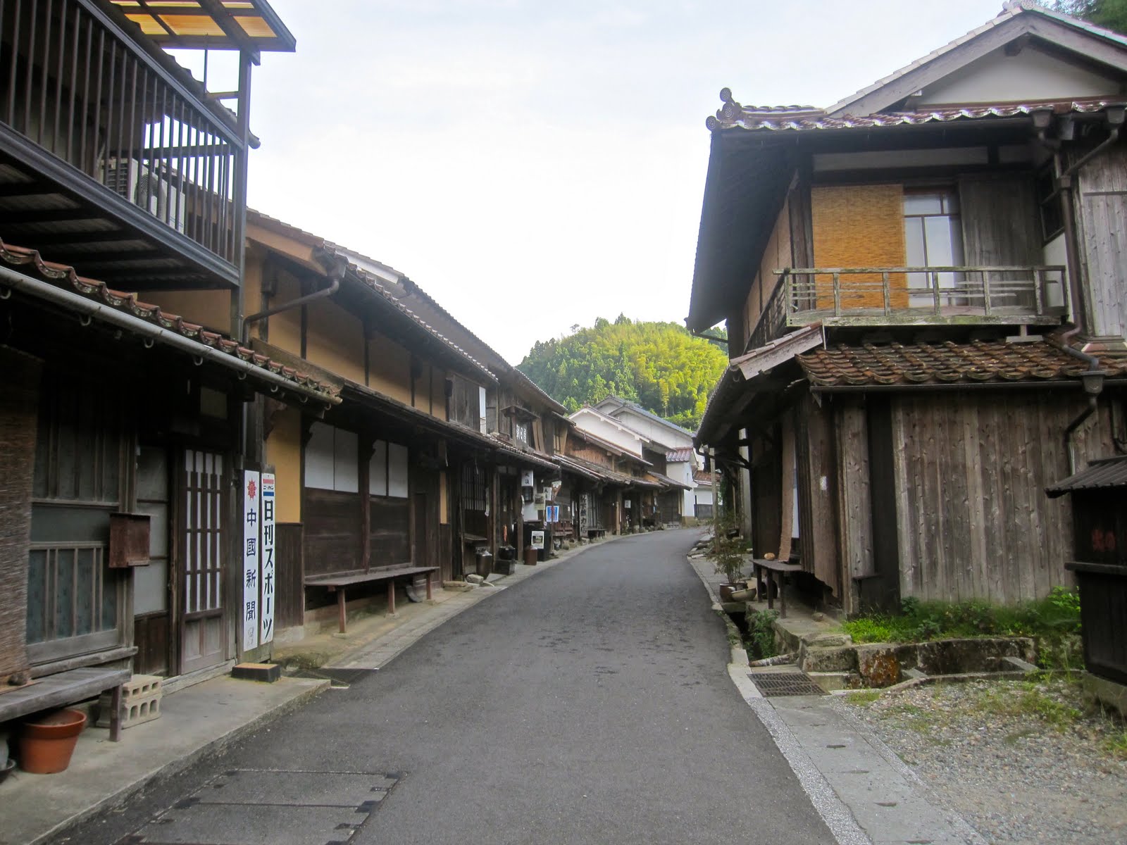
No. 5 is Tottori Castle or more properly the ruins of Tottori Castle in Tottori City, Tottori Prefecture. Nothing remains of the castle but its stone foundations and the original wooden gate (which has been reinforced with iron bars). Tottori Castle's dates of construction and full history of use are unknown but it is most famous for the 200 day long 1581 siege that eventually forced the castle's starving Daimyo, Tsuneie Kikkawa, to surrender to Toyotomi Hideyoshi. The reason the siege lasted so long is because Tottori Castle made great use of the landscape for defense. A river forms part of the moat, and the rest of the castle is built into the side of Kumatsu Mountain. The San no Maru (3rd [outer] circle) wall rises right out of the mountain-side of the river moat, and between there and the Ni no Maru (2nd [middle] circle) there are multiple walls that elevated the structures they once supported as high as 90 or so meters above the surrounding area. The actual Tenshukaku (the castle tower) was on the summit of Kumatsu Mountain, 263 meters above sea level. There are only 2 ways up to the Ni no Maru compound (and one of them appears to be a modern addition), and only 1 way (a long and steep climb) up to the Tenshukaku. Not much is left of the castle tower's foundation stones, but the view from the summit of Kumatsu Mountain affords one a 270º view of Tottori City, the Sea of Japan and the Tottori Sand Dunes. The best structures are between the moat and the Ni no Maru. Sakura and pine trees, and a small shrine in the compound make Tottori Castle a pleasant place to take a stroll and
Looking toward the Ni no Maru from the San no Maru.
probably a great place to view the sakura when they are in bloom. Tottori Castle gets demoted to last place in this article, however, because a 19th century, European-style mansion (Jinpukaku) where the Edo-era Ikeda Clan lived out its final days, and a junior high school are built within the moat on the grounds of the San no Maru. Both buildings detract somewhat from the overall experience. Tottori Castle Ruins are free and open 24/7. They are a ¥150 bus ride away from Tottori Station on the blue or red loop lines or on many of the other buses running through out the city. Check the signs or ask at the information center inside Tottori Station.

The foundations of Yonago Castle's Tenshukaku.
No. 4 is Yonago Castle in Yonago City at the far western edge of Tottori. Located atop a 90m hill at the base of the Sakai Peninsula, the castle has an unobstructed 360º view of the Nakaumi (Inland Sea), the Shimane Peninsula, the Sea of Japan, Yonago City and Mt. Daisen. The castle was a four story structure commissioned by Hiroie Kikkawa in 1591.
Shortly thereafter control of the castle was passed to Kazutada Nakamura who had the castle rebuilt as a 5 story structure. In 1632 the castle changed hands again, this time into the control of Naritoshi Arao, one of Ieyasu Tokugawa's high ranking samurai. Tragically,
Mt. Daisen and Yonago City
from the Tenshukaku Foundation.
the castle was deconstructed during the Meiji-era in the 1800s and its wood was used to stoke the fires of bath houses, so only the stone foundations remain. The castle compound is not expansive, but the remaining foundations are fairly tall. The foundation of the castle tower is visible from the road leading up to the castle and would be visible from much farther away if there were no buildings to block the way. Some benches and a gazebo on the highest part of the ruins (tucked away from view of the street), are nice places to sit down, have lunch, take in the view and watch the sun set over the Nakaumi. There are no buses that stop near the ruins of Yonago Castle, so your best option is to walk. It only takes about 10 minutes from the station and it's easy to find. Ask at the station's information center and they'll give you a map. No charge to go in.

Coming in at No. 3 is Hikone Castle near Lake Biwa in Shiga Prefecture. Hikone Castle is one of the 12
Hikone Castle Tower and Housho-Dai Tea
House from  the Genkyu-en Garden.
remaining original castles in Japan. The castle tower and all of the surrounding walls and turrets are original structures or structures that were refurbished in the Edo-era and have the status of, "National Treasure" and, "Important Cultural Assets."  The structure of Hikone Castle was originally located on the summit of Sawayama and was ruled by Mitsunari Ishida. Ishida forfeited the castle to the forces of Ieyasu Tokugawa after his defeat in the battle of Sekigahara. Naomasa Ii, the Tokugawa Allied General who prevailed at the battle of Sekigahara, was appointed the castle's new master. Ii ordered the castle be moved to it's present location in 1601. He died the following year but his son Naotsugu continued with the project, which, even with the full support of the Tokugawa Shogunate, took 20 years to complete. The expansive grounds of Hikone Castle include the pine tree lined Irohamatsu moat; the Genkyu-en Garden full of flowers, trees, ponds, walking paths, foot bridges and excellent views of Hikone Castle Tower - Genkyu-en is ranked as one of the best gardens in the nation; the Housho-dai Tea Room where one can experience a Japanese tea ceremony while taking in the beauty of the garden (¥500 for tea and a Japanese sweet); the Tenbin Yagura Turret, one of the final defensive structures before the castle tower, it is accessed by a wooden bridge crossing the rift between two rock walls and
is as near as Japan gets to the drawbridges associated with medieval European Castles (it could be demolished in an emergency); and of course Hikone Castle Tower. At only 3-stories in height, Hikone
Hikone Castle Tower
Castle Tower is not very large and it doesn't have any historical artifacts on display inside. The beautifully gabled construction and views of Lake Biwa and the surrounding mountains make the visit well worth it. The castle tower, the history museum and the Genkyu-en Garden all have admission fees. There is a universal pass that covers all 3, or a pass which covers your choice of 2. A long line at the history museum (and the historical nature of the whole compound) dissuaded me from visiting the museum so I visited the garden and the castle tower. The pass for 2 of the 3 admission fee sites is ¥600. Hikone Castle is a 5 minute walk from JR Hikone Station. A rapid local train from Kyoto will put you in Hikone in about 50 minutes at ¥1110 each way.

Minami and Naka Turrets.
Coming in at No. 2 and celebrating its 400th anniversary this year is Matsue Castle in Matsue City, Shimane Prefecture. Matsue is also one of Japan's 12 surviving original castles. Of those 12, Matsue Castle is the second largest, the third tallest and the sixth oldest. It was completed in 1611 by the Daimyo of the Izumo region, Yoshiharu Horio. Matsue Castle is a "practical" (war purposed) keep. Outwardly the castle appears to have 5 floors but the black walls of the lower levels conceal a sixth floor that was used to store food and weaponry should the castle come under siege. Matsue Castle was never challenged, and when it was ceded to the ruling Tokugawa Shogunate it was done by negotiated treaty. The original Higashi, Naka, Minami, and Otsukimi turrets and the original gate structure in the Ni no Maru surrounding the castle were dismantled and 1875 to prevent the castle being used as a base against the central government. They were restored in 2001 and look very much like the real thing. Matsue Castle itself was fully refurbished in the 1950s, but most of the structure (the floors, support pillars, window frames, etc...) remains original. Those things that were so old that they could not be reinstalled for fear that they would decay completely (among them the
Matsue Castle
"shachi" that graced the roof) are now on display at both the history museum and on the first floor of the castle. Matsue Castle also boasts an amazing collection of authentic samurai battle armor and helmets. If you like history you will enjoy that collection of artifacts greatly. The  360º view from the top floor of the castle is spectacular. On a clear day Mt. Daisen is visible to the east. The many walking paths on the grounds afford the visitor great views of the castle, the stone walls, the historic samurai residences that still stand on the castle's north side, and the moat. The moat itself is almost fully intact and the slightly Venetian feeling boat ride around the castle and through Matsue is not to be missed. Matsue Castle is easily accessed by the Lake Loop bus, ¥150 each way. Show your passport or your alien registration card and you're admission price is ¥280. The Castle Moat Sight Seeing Boat is ¥800.

Matsue Castle's orignal Shachi


The Minami Ni no Maru and Minami Senjo
from the foundation of the tenshukaku.
So how is it that a castle as cool as Matsue only makes No. 2? Here's No. 1, and here's why. Built in 1441 on the summit of a high mountain that towers nearly 1000ft over the surrounding terrain, the ruins of Takeda Castle cover an area a quarter of a mile in length and more than 300 feet in width. It was built in the path of aggression between the Yamana and Hideyoshi Daimyos, who were fighting for control of what is now northern Hyogo Prefecture, by a retainer of the Yamana Daimyo, Mitsukage Otagaki. The Hideyoshi family was able to conquer the castle in 1577. The castle's last lord was Hirohide Akamatsu, one of Ieyasu Tokugawa's soldiers who fought at the battle of Sekigahara in 1600. Within a year of being appointed the castle's lord, Akamatsu committed sepuku and Takeda Castle was abandoned. There is nothing left today but the stone foundations, however, the massive size of these structures, their location and area that they cover are unbelievable. It is incredible to think that this massive castle was built, and garrisoned on top of such a steep mountain using the primitive technology available in the 15th, 16th and 17th centuries. The town of Wadayama, whose jurisdiction the castle's maintenance falls into, has planted some sakura and pine trees on the castle's grounds, but they have kept any other plants from encroaching on, or growing near the edge of the castle preserving the 360º view over the whole area.
The tenshukaku foundation and Hon Maru complex from
the Minami Ni no Maru.
The castle is a great place to see fall foliage, sakura, or observe the "cloud sea" phenomena (best viewed in the early morning). The ruins of Takeda Castle are free, getting to them is not. The nearest city of any size is Toyooka on the San'in Main Line. The entrance to the castle is via a steep 1km long hiking course that starts next to Takeda Station on the Bantan Line, or by a taxi or car ride to the parking lot just below the summit. It is possible to see Takeda Castle Ruins as a day trip from Kyoto, but it is the only thing you will be able to do. It makes an ideal stop if you are en-route to Kinosaki Onsen or Tottori or Amanohashidate from Kyoto or a stop on the way back from those places. It definitely makes my list of, "things you must see in Japan." Happy travels.
The Hon Maru and tenshukaku foundation from the Kita San no Maru
The Minami Ni no Maru and Minami Senjo.

2011年8月18日木曜日

The Iwami Ginzan World Heritage Silver Mines

Inside the Ryugenji Mabu mine shaft.
The vast quantity of silver mined from the Iwami Ginzan Silver Mines in the mountains of Shimane Prefecture's Oda City once made Japan the world's third largest producer of silver. The mines of Iwami were in continuous production from the Sengoku (Warring States) Period in the 1520s, all the way up until the beginning of the 20th century when Iwami could no longer compete with mines elsewhere in the world. The Iwami Ginzan Silver Mines were granted the distinction of World Heritage Status in 2007. Despite the fanfare, Iwami Ginzan is both remote and not well known. I was fortunate to stumble across a small advertisement for a day trip to Iwami Ginzan in a travel brochure. Because of this overall lack of awareness, tourism facilities near the Iwami area are just now being developed. The lack of awareness also results in a lack of crowds which makes a visit to Iwami all the more enjoyable. Even more good news for foreigners, many of the museums and sites in Iwami offer a foreigner discount of up to a 50%! Just show your passport or alien registration card.
The entrance to the Okubo-Mabu.
     Iwami makes a perfect day trip for anyone staying in Matsue. Get an early morning train (I recommend the 7:18am local train ¥1110/one way, or the 8:36am Super Matsukaze ¥2260/one way non-reserved) from Matsue to Odashi Station. An express train will take just under an hour, a local train about an hour and a half. Try to get to Odashi before or after the 10 o'clock hour because there are no buses to Iwami during that time. Once in Iwami, the most interesting things to visit are the mine shafts themselves. Known as "Mabu" (間歩) in Japanese, there are 2 that you can go into, the most well advertised of which is the Ryugenji-Mabu (龍源寺間歩). Located all the way at the top of the road in the town of Omori, Ryugenji-Mabu is 2.3 kilometers (1.4 miles) from the Omori bus stop. You can walk or rent a bicycle at the bus stop (¥500 for a regular bike, ¥700 for an electric assisted bike). Show your passport or alien registration card at the Ryugenji-Mabu ticket office and the regular ¥400 ticket will cost you just ¥200! Mined mostly in the period before the introduction of dynamite, the developed part of Ryugenji-Mabu goes back 158m (~518ft) into the side of a mountain before turning left and exiting through a tunnel dug in the 20th century to make the mine tourist friendly. The mine's tunnel continues another 90m (almost 300ft) past this point, but it narrows in both width and height. The rock further back is also unstable. There are several smaller side tunnels and narrow rooms along Ryugenji-Mabu's main shaft - many of which are large enough to go into - that were created when the veins of silver were dug out of the mountain. In addition to the historic environment, the 60 something Fº temperature inside Ryugenji was a great way to beat the fierce summer sun. For the slightly expensive price of ¥3800, one can tour the other mine shaft open to tourism, the Okubo-Mabu (大久保間歩). The tours are conducted by the World Heritage Center (in Japanese only though English pamphlets are readily available) and admission is limited to four tours a day, 9:30, 10:30, 12:15, and 1:15, weekends and national holidays only. The Okubo-Mabu was continuously mined from about the middle of the 1500s until the beginning of the 20th century making it one of, if not
The remains of an ore cart track in the Okubo-Mabu.
the longest operating mine in the area. It is also much larger then Ryugenji and functionally undeveloped. You will have to wear boots and a helmet, and carry a flashlight while touring this mine. In addition to making you feel like a real miner, the Okubo-Mabu is a living history lesson. The walls of the mine have two different textures as a result of the different methods used to mine the tunnel. The Pre-Edo/pre-dynamite parts of the mine shaft were carved by hand and are fairly smooth, squared off and quite small. The parts of the tunnel that were mined or expanded in the later part of the mine's history, after the introduction of dynamite, are rough, full of drill holes and large. Parts of the tunnel are almost 3 stories high. Deep (some seemingly bottomless) ore shafts leading off of the main tunnel, the remains of the ore cart tracks and the beautiful hike to, from, and around the Okubo-Mabu are other things to look forward to on the tour.
The main street of Omori.
    After touring the mines take a stroll down the streets of the barely-modernized village of Omori. Apart from the paved streets, a/c units and some power lines, the wooden and stuccoed buildings of Omori will give you the feel of Edo Period Japan. There are many stores, ryokans, samurai residences and other historical structures that visitors are allowed to enter and walk around. There is also a hiking path to the remains of Yamabuki Castle which makes a loop from the entrance of the Ryugenji-Mabu to Seisuiji Temple. Don't expect to see stone foundations, however, all that remains of Yamabuki Castle is some slopes where the walls once were and the flat areas on top of those walls. The trail is best climbed for its unobstructed views of Mt. Sanbe, 1126m (3693ft), the highest mountain in Shimane Prefecture, the port villages of Maji and Yunotsu, and the Sea of Japan.
Mt. Sanbe from the ruins of Yamabuki Castle.
   In addition to the Mabus and Omori, the Iwami Ginzan World Heritage Site also encompasses the port onsen village of Yunotsu, where supplies for the mines were brought in from Hakata Port, and the port village of Maji, where Iwami Ginzan's silver was exported. Historical onsens and ryokans, slick-ways and mooring rings carved out of the rocks, castle ruins, coastal hiking trails and swimming beaches await. I didn't make it to either port village on my trip but I enjoyed Iwami enough to go again and pick up what I missed. Happy travels!

2011年8月12日金曜日

Climbing Mt. Daisen

Mt. Daisen from the Daisen Loop Bus
My great West Japan Adventure just came to a close and boy was it a good one. While traveling through Tottori and Shimane Prefectures I had the opportunity to climb Mt. Daisen, a volcano that is so perfectly symmetrical from some angles that it is known as, "the Fuji of the West," and at 1729m (that's 5671 feet to everyone who uses imperial), it's also the highest mountain in West Japan. Being from Denver, 5671 feet doesn't sound like much to me. Even though one views all 5671 feet of Daisen from sea level in the nearest city of Yonago, I still thought the climb would be easy. Don't make my mistake. I didn't fall victim to altitude sickness, but my initial pace was far too fast to maintain. Mt. Daisen is extremely steep and therefore punishing to one's entire body (particularly one's knees). That aside, the climb to the summit of Mt. Daisen is a "must do" experience if you are in Tottori. Gorgeous wild flowers, pristine forests and views all the way to the Oki Islands almost 60 miles out into the Sea of Japan on a clear day await you from anywhere the trees don't obstruct your view.
      Tottori Prefecture is the least populated Prefecture in all of Japan with fewer than 600,000 people but, there are plenty of cheap accommodations all over the place. In Yonago City, the closest city to Mt. Daisen, the Frontier Hotel just across the street from Yonago Station, offers non-smoking single rooms from ¥3700/night, or if you're a member of CouchSurfing.org you can pick up a couch for free with one of the many couchsurfers in Tottori Prefecture.
The main street of Daisenji
     Mt. Daisen itself is a short bus ride from Yonago Station. Go to the bus terminal located just to the west of the train station and buy a 1-day Open Ticket for the Daisen Loop, it'll cost you ¥1100 and is cheaper than the regular round trip fare. Get the bus from the well marked platform in front of the station (it leaves about once every 2 hours 20 minutes after the start of the hour starting from 7:20 am), and take it all the way until the final stop of Daisenji, about 30 minutes away. The bus drops you off at the Mt. Daisen Information Office where you can check on the climbing routes, conditions, collect pamphlets, and maps. English speaking staff are on hand and all of the brochures and maps are available in English. Once you've collected the information you need and want, head for the Mt. Daisen Trailhead. Walk up to the main road and follow it up the hill until it reaches a point where it flattens out. There are 2 omiyage stores on opposite corners to your right. Turn right down this street and walk until you cross the bridge over the small river. You will pass a Mont Bell store and enter a parking lot with a bathroom. If you need to go, this is the place, there is not another bathroom until you get to about 1400m up the mountain. Walk to the top of the parking lot and start climbing. Until you get close to the 1600m mark, the climb will be very steep and full of tall stairs. Pace yourself. Drink lots of water. Take as many breaks as you need, and pack a sweat towel.
This is the trail above the parking lot. It gets even steeper higher up.
     As you ascend higher onto the mountain, the forest changes from the tall mixed pine and deciduous trees at lower elevations, to shorter scrub oak and other small vegetation that is about head height, giving way at last to open mountain meadows with fields of blue, pink, red, purple and orange wildflowers! The great "wall" of Daisen and it's sub-peaks (Mt. Daisen suffered a Mt. St. Helens-esque eruption several thousand years ago that blew out its north east flank) appears multiple times through the trees, as do views of Yonago and the Sea of Japan affording many opportunities for photos.
The elevated boardwalk by the summit hut.
    Once you get to 1400m, the 6th Station (you encounter signs that have a number and the kanji 合目 every 100m of vertical elevation gain), you reach a large rest area that has bathrooms and a good view of the surrounding area. This is your last chance to use a bathroom before the summit. After the 1400m bathrooms, the plants get shorter and scrubbier until they are about head high. At 1600m you will reach the rim of the volcanic crater and the steepness of the climb is drastically reduced. The final 100 vertical meter climb to the summit is barely inclined compared to the rest of the ascent. The trail is transferred to an elevated wooden boardwalk making the last bit of going really easy. It is at this point also that you will encounter the gorgeous upland wildflowers Mt. Daisen has to offer. Refreshing breezes and excellent views reward the determined climber. After reaching the boardwalk it's just a few more minutes to the Mt. Misen Summit (1710m or 5609ft), the official high point of the climb (the true summit of Mt. Daisen is Kengamine, Japanese for the highest point on a mountain with multiple peaks). There is a small mountain hut with a sleeping loft, at no charge to anyone who wants to camp, but nothing in the way of cooking facilities or running water. There is also board walk amphitheater topped by a summit marker. This is where people congregate to celebrate their climb, take photos and eat lunch. Climbing past Mt. Misen to the true summit of Kengamine, while not illegal (the signs say it's dangerous please don't climb past this point), is strongly discouraged by the National Park Service owing to a short section of narrow loose rocks. If I hadn't consumed all my water I would have pushed onto the summit. Anyone wishing to do so is advised that help will be very slow and difficult to mobilize if you fall. Continue at your own risk.
The summit of Mt. Misen
    After taking all the pictures you need and having an adequate rest, descend Daisen the way you came. You can also descend via the Motodani trail (which meets the Mt. Daisen trail at about 1200m). The Motodani Trail will take you into the bottom of the volcanic crater and put you out at the Daisen Temple. It's a very pretty hike and very steep until you get near the bottom of the valley. The highlight is being surrounded by the entire wall of Mt. Daisen. Safe climbing!
Wildflowers of Daisen


View from just below the summit looking east-north-east across
the Motodani Valley toward a sub-peak of Daisen

Looking up at the Kengamine Peak from Motodani Valley